
Hertfordshire Sport Partnership (HSP) is a key partner in coordinating Hertfordshire’s Holiday Activity and Food Programme (HAF).
In 2021 there were 25,319 children in Hertfordshire eligible for the DfE funded Holiday Activity and Food Programme. To be eligible for free HAF funded holiday provision, children must be eligible for benefits related Free School Meals (FSM). The Herts HAF project is coordinated by three key partners in the county – Hertfordshire County Council (HCC), Herts Community Foundation (HCF) and the Herts Sports Partnership (HSP).
In Hertfordshire, HAF is branded as HAPpy: Holiday Activity Programme. Activity providers apply for grant funding to run HAF activities during the Easter, Summer and Christmas School holiday periods.
A brief look at the number of children eligible, the number of activities offered, number of venues, and number of activity providers awarded funding, demonstrates the challenge faced by HSP in ensuring that funds, venues and activities were being targeted to the areas that they are most needed in.
These are the HAPpy programme details for 2021.

It is crucial for HSP to be confident that the support and services the HAF programme coordinates is targeted to the communities where the need is greatest and that have the largest numbers of eligible children. In other words, that the place-based philosophy that underpins HAF is evidenced by real world data and understanding of communities.
Since 2019, Hertfordshire Sport Partnership have been using Local Insight to support a place-based approach to sports development and health improvement projects across Hertfordshire.
From the outset of the HAF project in 2021, HSP planned to use the Local Insight Tool in the following ways:
Local Insight allows users to draw on a map and create custom areas that reflect true geographies of communities as they exist.
Prior to the HAF programme, HSP used the custom areas function to investigate areas of interest. This meant that they already understood the benefit of being able to analyse data for bespoke geographies and the comparison this allows – for example comparing the distribution of funding across the different districts of the county.
Creating custom areas is relatively simple, either drawing custom areas on the map or selecting and combining LSOAs/ MSOAs to form the custom areas of interest. The main areas mapped were:
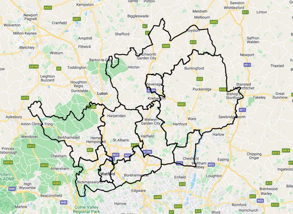
Hertfordshire County
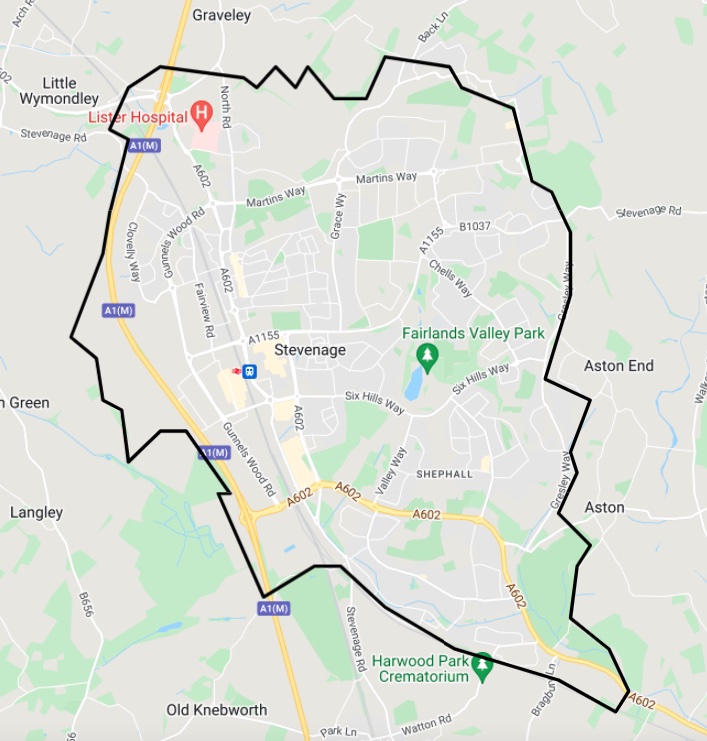
Stevenage District
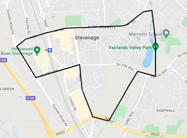
Bedwell Ward
Local Insight aggregates datasets in the tool to any custom area created so it is possible to build a comprehensive understanding of the challenges faced by any particular community.
In addition to the hundreds of indicators available on Local Insight, HSP were able to add additional local data to support the HAF project.
Using anonymised registration data from Hertfordshire County Council, HSP were able to generate a heat map highlighting the distribution of pupils registered for FSM across the county.
The data from the county council contained the home postcode for each child or young person in Hertfordshire registered for FSM. It is a straightforward process to upload this data using Local Insight’s upload wizard, and then be able to generate the heat map highlighting the distribution of children on FSM.
This mapping was invaluable in identifying areas where there were high levels of children and young people eligible for HAF, enabling HSP to ensure that sufficient activities were funded in these areas.
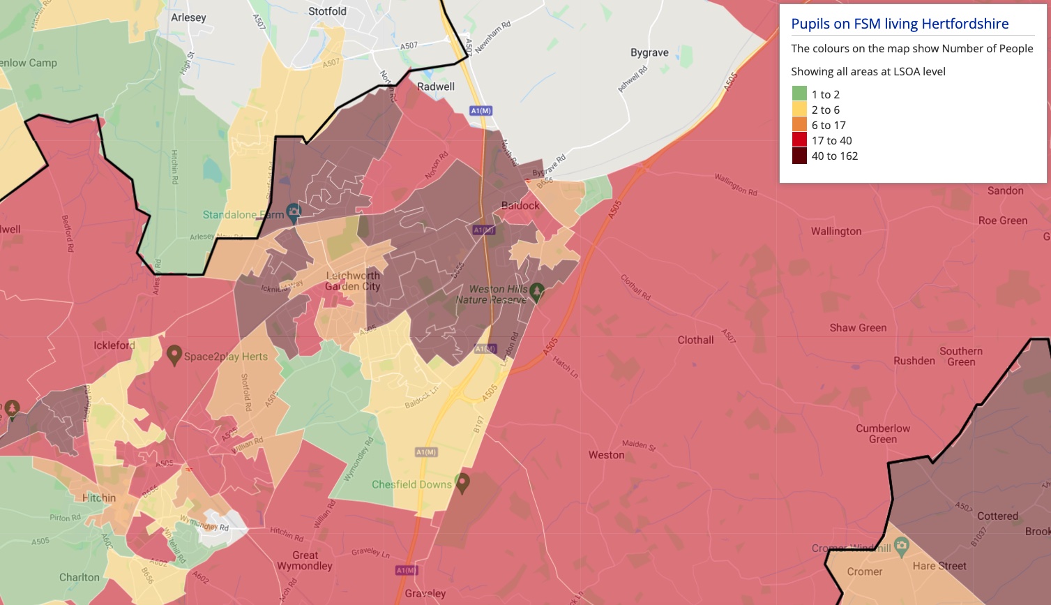
Heat Map showing distribution of Pupils on FSM living in North Hertfordshire.
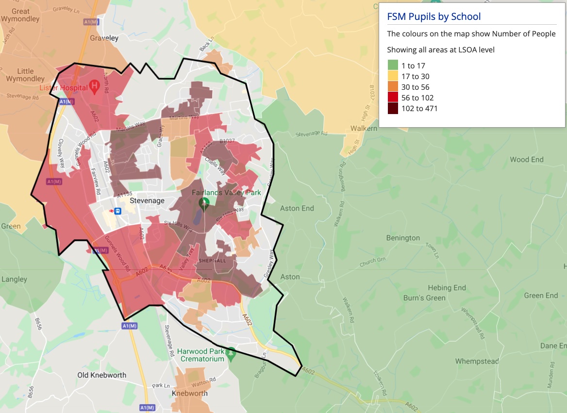
FSM Heat Map of Stevenage District – shared on the HSP website
In addition, HSP published ten district level heat maps on their website as part of the funding application FAQs so that potential activity providers could clearly see, at a very local level, areas of high FSM populations, and could therefore ensure that their funding applications for HAF activity venues were insight led.
Activity providers in Hertfordshire were able to apply for funding to run HAF activities. Following the closure of the application window for each holiday period the HSP were able to map the proposed HAF activity venues.
Using the Services function in Local Insight, HSP were able to map, or pinpoint, each funding application on the county map.
Using Local Insight’s services template is a simple process that allows a user to record the location of each venue or service, or any location point of interest, by plotting its postcode. Using the metadata fields within the template it is possible to record more information for each location, thus having headline level data available to anyone viewing the map. HSP recorded the provider name, number of places applied for, funding applied for and the age suitability.
By plotting the location of proposed activities over the FSM Heat Map, HSP could gain useful insight before assisting their coordinating partners in deciding what projects to fund.
Following the delivery of each phase of the HAF programme, HSP were able to use booking and attendance reports to add further custom data to Local Insight.
These were the key indicators HSP added following completing of the programme:
Using the Local Insight Dashboard Tool, HSP is able to produce detailed reports of the HAF programme. After choosing the desired indicators, the Dashboard shows a breakdown of the HAF data by each mapped area, including any custom areas.
The Dashboard can also be exported in CSV format for further manipulation or inclusion in reports.
This was very useful when compiling reports for the different local authority areas and in particular for sharing with the relevant local Sports Development teams.
Hertfordshire Sport Partnership continues to find Local Insight invaluable in supporting the coordination of the HAF programme and other sport, physical activity and health programmes throughout Hertfordshire.
HSP has committed to using the tool through 2022.
To ensure that the HSP team and delivery partners have greater awareness of the insight available, HSP ensures that all new staff are trained to use and understand Local Insight, and that updated training for existing colleagues is ongoing, including workshops for Local Authority partners so they understand the scope of insight available.
Within the HSP team, the group admins or Local Insight leads keep up to date on updates to the tool and ensure that local data uploaded by their team is kept relevant and up to date. The Local Insight team manage and update all of the data that they upload to the tool so HSP can be confident that they are using the most up-to-date data available at LSOA level.
The newly launched multi-map analysis feature within the Local Insight platform encourages…
More
Brighton & Hove Food Partnership (BHFP) is a citywide charity that works…
More
You don’t need to spend hours making ward profile reports. If you…
More