Data from Scotland’s 2022 Census has been published at Output Area level, and can now be accessed within Local Insight.
The census is one of the most important data releases for those using place-based data across local government and beyond.
It gives us the fullest and most robust picture of all the people and households within Scotland – and for their 2022 Census, the National Records of Scotland gathered, analysed and presented over a billion statistics.
Scotland’s Census 2022 covers an enormous range of topics, including
To explore the Scottish Census 2022 data within Local Insight for your areas, book a demo today.
Already have a subscription to Local Insight, but don’t have access to Scotland? Get in touch with us at support@ocsi.co.uk to talk about adding it to your subscription.
*At the time of publication (March 2025), this dataset isn’t currently available at small-area level so is not currently available within Local Insight.
Scotland’s latest Census was initially planned to be held in 2021, but several issues caused by the COVID-19 pandemic affected this. As a result the date of the Census was postponed to Sunday 20 March 2022.
Since late 2023, there has been a steady stream of releases – however, for use within Local Insight, were were waiting on two major data publications from Census 2022:
Output areas (OAs) in Scotland are small statistical units, each covering 60 – 90 people or 25 – 89 households, designed to protect confidentiality while providing detailed local data.
Following each census, Scotland revises its output areas. In 2022, 46,363 OAs were defined based on updated population data.
Some remained unchanged, while others were redrawn to reflect population shifts and maintain alignment with administrative boundaries. These OAs nest within larger data zones (which roughly have a population of 500 – 1000 people) and intermediate zones (which roughly have a population of 2,500 – 6,000 people), ensuring consistency and enabling reliable geographic comparisons.
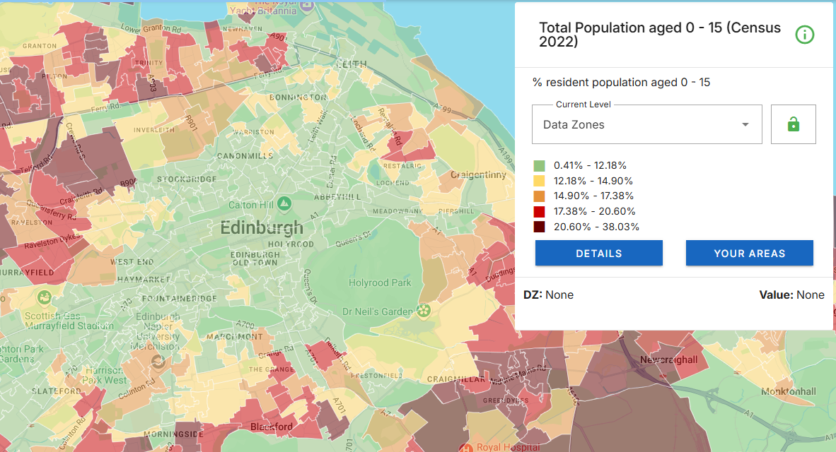
Data showing Total Population aged 0 – 15 from Scotland’s Census 2022, displayed at Data Zone level within Local Insight.
To ensure that all data is mapped to up-to-date figures showing where people reside – we always aim to use the latest available boundaries within Local Insight. With this release, all statistical geographies within the platform are the latest available.
Once these geographies were in place, we were then able to import the Census 2022 data to the platform, with the knowledge that it was showing accurately based on the latest population data.
You can find more about Scotland’s statistical geographies within our article on the OCSI blog: Scotland’s statistical geographies: A comparison with England and Wales.
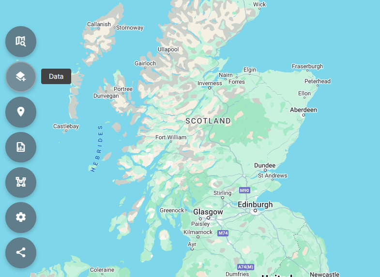
We’ve set-up a Public Site with key data from Scotland’s Census 2022 hosted within it, for you to explore entirely for free.
Scotland’s Census 2022 – Local Insight Public Site
To get started, simply click on the ‘Data’ symbol on the left. You’ll then find the Census indicators within the themes, which you’ll be able to explore for all of Scotland, down to Data Zone level.
If you’re interested in mapping the data for the areas that matter to you, get in touch about a Local Insight subscription.
The platform allows you to define your own areas, no matter the shape or size – and then map the data to those areas.
Interested in finding out more? Book a demo today and receive a two-week free trial.

Analysts are often under pressure to answer complex questions quickly, while also…
More
We have updated the Children in Low Income Families (CiLIF) indicators from…
More
One of the core ways that Local Insight is used is to…
More