Two new measures, the Welsh Community Assets Index (WCAI) and the Welsh Community Resilience Index (WCRI), are now available to explore within Local Insight’s maps and dashboard. We’ve also added both datasets to the Community Custom Report Theme.
Across Wales there are areas that lack important local assets such as community centres and civic spaces while others face high levels of deprivation and poor economic outlook. There are many that are challenged with both.
In 2020, OCSI was commissioned by the Building Communities Trust (BCT) to create datasets that could be used to uncover community need across Wales at a local level – allowing policymakers and third sector organisations to target interventions where need is highest.
Since then, the measures have been used to inform over £1.6 million of funding, and have been referenced and cited by several elected members in the Senedd.
We’ve written about these measures in detail over on the OCSI blog, and explored the ongoing impact that they have within Wales.
Local Insight is an easy and intuitive platform that offers exploration of the WCAI and WCRI as well as hundreds of other datasets at a small-area level, helping you to quickly identify the hotspots of deprivation and need through interactive maps and dashboards.
With Local Insight, you can:
The WCAI builds on earlier work mapping social infrastructure in England through the Community Needs Index (CNI). Using a similar methodology, the WCAI identifies places in Wales with fewer civic and social assets, across three domains:
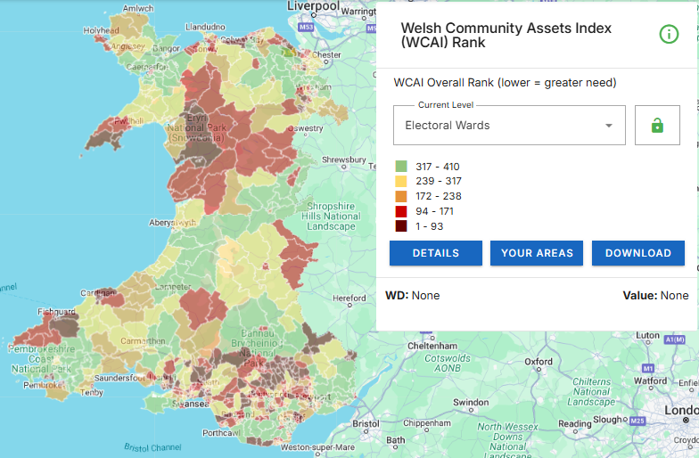
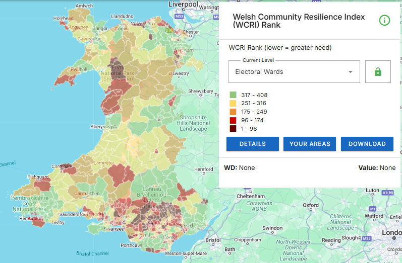
The WCRI combines the WCAI with the Welsh Index of Multiple Deprivation (WIMD) – the official national measure of deprivation. This combined view helps you to find the highest scoring areas as ‘Less Resilient Areas’ – the places where communities are especially vulnerable, and facing both high levels of deprivation and lacking the things that make a community strong.
You can find out more about the WCAI and WCRI and their development on the BCT website.
The WCAI and WCRI are available within Local Insight for Wales, along with a growing library of more than 1200 indicators covering demographics, housing, health, education and more.
If you’re an existing user and would like access to Welsh geographies or datasets, please contact your account manager or email support@ocsi.co.uk
If you’re new to Local Insight and want to see how it can support your organisation, book a demo to find out more.

Natural England recently launched the Index of Multiple Environmental Deprivation, or IMED:…
More
Analysts are often under pressure to answer complex questions quickly, while also…
More
We have updated the Children in Low Income Families (CiLIF) indicators from…
More